
What Bottle Beach is and where it is
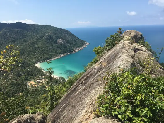
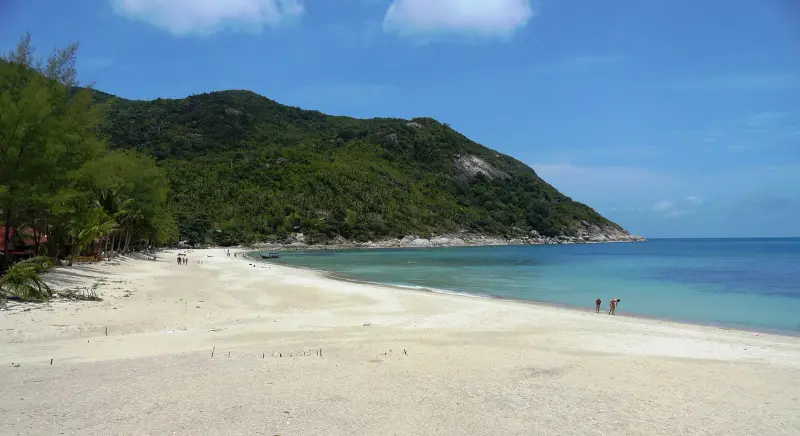
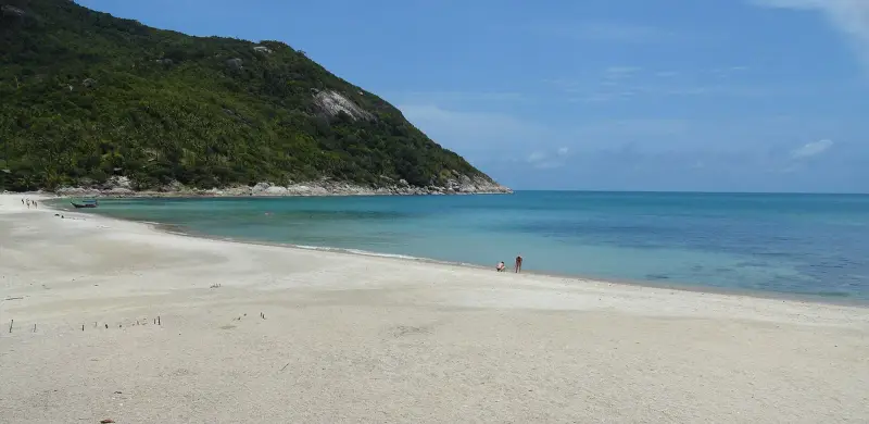
Bottle Beach (Haad Khuat) is a cove on the north coast of Koh Phangan, on the Gulf of Thailand, between the bays of Chaloklum and Thong Nai Pan. According to Wikipedia the name comes from the shape of the sheltered cove: seen from a rock, it looks like a bottle. In OpenStreetMap it is a small settlement with a sand beach that has no lifeguards. For the island as a whole, with seasons and ferries, see Koh Phangan travel guide.
There is no direct road from the island’s main road: from Thong Sala pier it is about 19 km and 41 minutes by OSRM routing, and the last stretch is a dirt track. From Chaloklum pier the road is 26.5 km and about 50 minutes, while the sea route is about 5 km, which is why most people take the boat.
What you will see
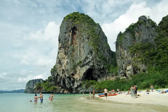
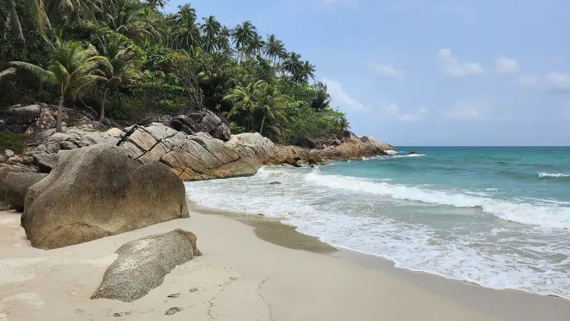
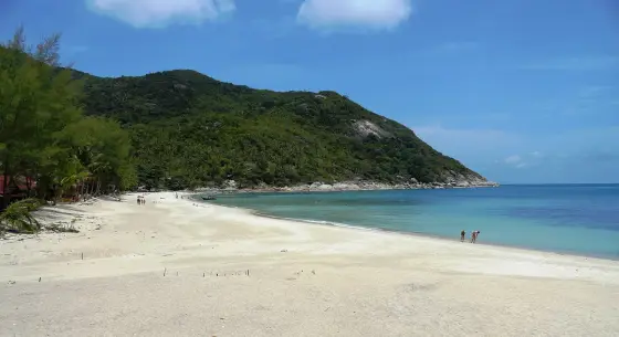
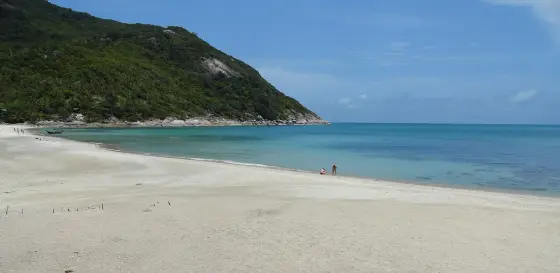
- The bay. Soft sand and calm water, shallow near the shore (Thai Holiday Guide)
- Rocks at both ends. You can snorkel off the rocks at either end of the bay
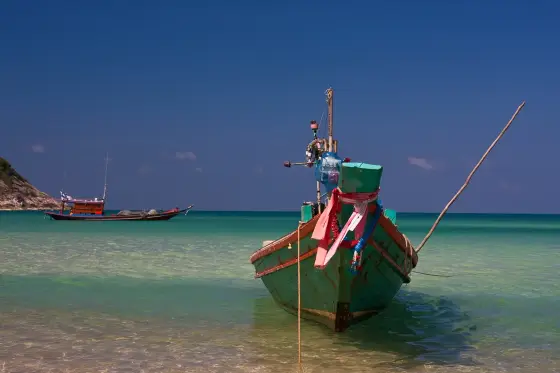
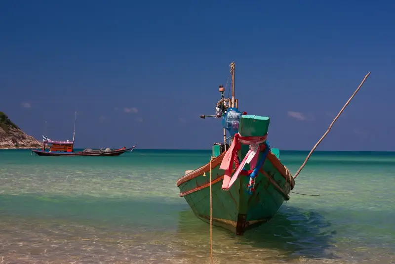
- Longtail boats. Boats from Chaloklum pull up at the beach
- Simple bungalows and cafes. No large resorts, basic rooms, limited power after dark
How to spend the day
There is no set programme here, the day is built around the boat.
- Get to Chaloklum pier: 10.5 km from Thong Sala pier, about 13 minutes
- Board the boat: from about 8:00, it leaves with four or more passengers, about 30 minutes at sea
- Swim, sit in a cafe, snorkel off the rocks
- Agree on the return: the last boat is about 17:00 according to the guide, so check with the boatman when you land
If you travel alone you may have to wait for others: boats leave once four or more people are aboard.
How long it takes and when to go
With the road, half a day is enough, and a slow beach day takes up to 8 hours. You can stay overnight in simple bungalows, but power is limited after dark. TMD normals for Ko Samui, the nearest station to Phangan (1991-2020), show February (64 mm) and April (83 mm) as the driest months and October-December as the wettest, with 445 mm in November.
| Period | What to expect |
|---|---|
| February-April | the driest months |
| May-September | less rain than in autumn, 102-134 mm a month |
| October-December | rainy season, peak in November, trail and road are slippery |
| January | transition month |
Our sources do not say how boats cope with strong waves, so ask a boatman in Chaloklum on the day.
How to get there and how long it takes
- Boat from Chaloklum. The main way. OpenStreetMap shows a boat line Chaloklum, Bottle Beach, operator Longtail Boat, about 5 km. Thai Holiday Guide gives 30 minutes at sea and departures from 8:00 to 17:00. Wikivoyage also recommends the boat because the road is bad
- From Thong Sala pier. To Chaloklum pier it is 10.5 km and about 13 minutes by road (OSRM). Chaloklum pier in OpenStreetMap is way 172248892
- On foot from Haad Khom. The trail starts at Haad Khom beach, about 2.3 km in a straight line from Bottle Beach. Guides say 1.5 hours (Thai Holiday Guide) and 2-3 hours on a steep, overgrown trail (Wikivoyage)
- By dirt road. The road from the east, from Thong Nai Pan, is described as rough: Wikivoyage mentions potholes and Thai Holiday Guide a 4WD. It is dangerous after rain. Leave a scooter before the steep descent
National park fee and the boat fare
We found no DNP fee for the beach. On the page of Than Sadet-Ko Pha-ngan National Park, 26,866 rai, DNP names the Phaeng and Than Sadet waterfalls and a nature trail and does not mention Haad Khuat. For the waterfalls a foreign adult pays 100 baht and a child 50 baht under the DNP table (edition of 02.06.2023). You pay the boatman on the spot, in cash. We do not quote a fare because we found no official tariff.
Options: boat, trail, road
| Option | Time | Who it suits | Downside |
|---|---|---|---|
| Longtail from Chaloklum | about 30 minutes | almost everyone | waiting for a fourth passenger, cash only |
| On foot from Haad Khom | 1.5-3 hours | people used to jungle walking | steep, overgrown trail, hot |
| Dirt road | about 41 minutes from Thong Sala pier by routing | confident 4WD drivers | rough, dangerous after rain |
| Overnight in a bungalow | 2 days | people who want quiet | limited power after dark |
What to do in rain and waves
In rain the trail and the dirt road get slippery, so it is better to postpone. Boat runs depend on the waves and our sources do not say at what wave height they stop: ask the boatman in Chaloklum. If the day is lost, the island has the waterfalls of Than Sadet-Ko Pha-ngan National Park, see the Koh Phangan travel guide.
Safety
- Lifeguards. OpenStreetMap marks the beach as unsupervised. Swim near the shore, especially with children
- Currents and jellyfish. The UK FCDO warns about strong currents in the rainy season and about jellyfish from May to October, whose stings can be dangerous
- Boats. Wikivoyage notes that Thai boatmen often overload longtails: if a boat looks overloaded, wait for the next one
- The trail. Take water and closed shoes, the trail is steep and overgrown
- Insurance. Check that your policy covers injuries and evacuation
Who it suits and who should skip it
- Suits. People who want a quiet cove without roads or crowds, couples and groups, and families with children if they come by boat
- Suits. Anyone staying overnight in simple bungalows
- Skip. Anyone who needs ATMs, shops and nightlife
- Skip. Anyone who needs lifeguards on the beach
- Skip. People who get very seasick on small boats and anyone not ready for a trail or a rough road
If you want the opposite of this, look at the Full Moon Party at Haad Rin on the south-east of the island.
FAQ
How do you get to Bottle Beach?
The easiest way is a longtail boat from Chaloklum: about 30 minutes, roughly 8:00 to 17:00, leaving once four or more passengers are aboard (Thai Holiday Guide, July 2026). On foot you start from Haad Khom beach, 1.5-3 hours depending on the guide. By road from Thong Sala pier it is about 19 km and 41 minutes by OSRM routing, but the last stretch is a rough dirt track.
Can you walk to Bottle Beach, and how long does it take?
Yes, the trail starts at Haad Khom beach and crosses jungle. Guides disagree on the time: Thai Holiday Guide says 1.5 hours, Wikivoyage 2-3 hours on a steep, overgrown trail. In a straight line it is about 2.3 km from Haad Khom (our calculation from OSM coordinates). Take water and closed shoes, and you can return by boat from Chaloklum.
Can you reach Bottle Beach by scooter or taxi?
The dirt road from the east is described as one of the worst on the island: Wikivoyage mentions potholes and says the taxi fare is high, so the boat is the better choice. The road is dangerous after rain. If you ride, leave the bike before the steep descent and walk. For most people the boat from Chaloklum is easier and safer.
Is it safe to swim at Bottle Beach, and are there lifeguards?
OpenStreetMap marks the beach as having no lifeguards. Thai Holiday Guide describes a calm bay, shallow near the shore, with snorkelling off the rocks at each end. The UK FCDO warns about strong currents, especially in the rainy season, and about jellyfish from May to October. Swim near the shore and watch the weather.
Can you go to Bottle Beach with kids?
Yes, if you come by boat: the bay is calm and shallow near the shore. There are no lifeguards, so parents supervise, and we could not confirm whether boatmen carry life jackets. The trail and the dirt road are hard with small children. Bring water and a snack.
What is there on the beach: food, rooms, an ATM?
A few simple bungalows and cafes, no ATM, and boats and bungalows take cash only, with limited power after dark (Thai Holiday Guide, July 2026). Wikivoyage notes there are no shops at the beach and you eat at your accommodation. Bring cash and water.
When is the best time to go to Bottle Beach?
TMD normals for Ko Samui show February and April as the driest, with 64 and 83 mm of rain, and October-December as the wettest, with 445 mm in November. Our sources do not say how boats cope with strong waves, so ask a boatman in Chaloklum on the day.
Do you pay a national park fee at Bottle Beach?
We found no DNP fee for the beach. The Than Sadet-Ko Pha-ngan National Park page (26,866 rai) names the Phaeng and Than Sadet waterfalls and a nature trail and does not mention Haad Khuat. For the waterfalls a foreign adult pays 100 baht under the DNP table. Boatmen and bungalows charge separately for their services.
Sources
- Thai Holiday Guide. Bottle Beach, Koh Phangan (updated July 2026)
- OpenStreetMap. Hat Khuat (Bottle Beach), way 170860502
- OpenStreetMap. Chaloklum, Bottle Beach boat line, way 482584815
- OpenStreetMap. Chaloklum Pier, way 172248892
- OpenStreetMap, OSRM route: Thong Sala pier to Bottle Beach
- OpenStreetMap, OSRM route: Thong Sala pier to Chaloklum pier
- DNP. Than Sadet-Ko Pha-ngan National Park
- DNP. National park entrance fee table (edition of 02.06.2023)
- Wikivoyage. Ko Pha Ngan (Bottle Beach section)
- Wikipedia. Hat Khuat
- UK FCDO. Thailand: safety and security
- TMD. Climatological Data of Thailand for 30 Year Period (1991-2020), Ko Samui station
Found an error or outdated fact? Tell the editors, we will fix it and update the check date.