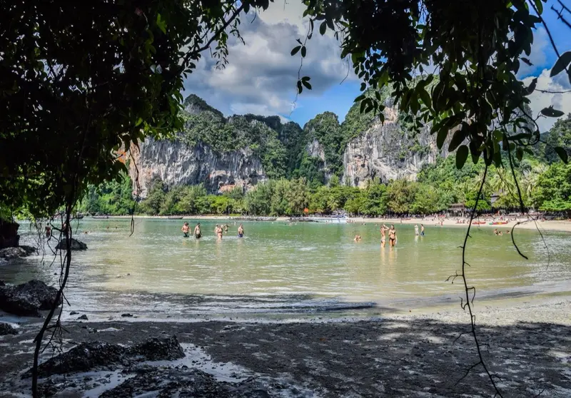

Where Railay is
Railay (ไร่เลย์, also spelled Rai Leh) is a peninsula between Ao Nang Beach and the mouth of the Krabi River. Administratively it is part of Ao Nang subdistrict, Mueang Krabi district, and DOPA publishes no separate population figure for it. Limestone mountains close it off on the land side, so OpenStreetMap shows no road at all to Railay’s beaches.
The main beaches are West Railay, where boats from Ao Nang land, and Phra Nang beach at the southern tip, below a cliff with a cave. According to DNP, Phra Nang beach and cave are part of Hat Noppharat Thara-Mu Ko Phi Phi National Park.
Who Railay suits
- People who want a few days without cars. You walk everywhere, the only transport is by boat
- Day visitors. It is one boat ride from Ao Nang, and sea tours from Phuket stop at Railay and Phra Nang too
- People coming for the cliffs. Limestone walls rise straight above the beaches
- Dry-season visitors. December to April is drier: February has 4 rainy days under TMD normals
Who should look elsewhere
- People with heavy luggage or a pushchair. There is no pier with road access; luggage travels in the boat and you carry it ashore
- People who need medical care close by. There is no hospital on the peninsula. The nearest, Wattanapat Ao Nang, means a boat to Ao Nang and then 3.6 km by road
- Buyers. Railay has no condos on the Treasury register and none in our catalogue
- Summer visitors. May to November brings 17-21 rainy days a month and boats do not run in storms
Railay by the numbers
| Indicator | Value | Source, date |
|---|---|---|
| Roads | none | OpenStreetMap, 17.10.2026 |
| National park fee (Phra Nang) | 200 baht, child 100 | DNP table 02.06.2023 |
| Condos on the Treasury register | 0 | Treasury, snapshot 05.08.2024 |
| Ao Nang Beach to KBV airport | 27.7 km, 33 min | OSRM, 17.10.2026 |
| Annual rainfall | 2,180.7 mm | TMD, Krabi station |
| Driest month | February, 35.9 mm | same |
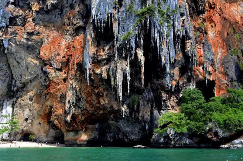
Railay’s beaches
| Beach | What it is |
|---|---|
| West Railay | the main swimming beach, where longtails from Ao Nang land |
| Phra Nang | beach below a cliff with a cave at the southern tip, inside the national park, fee 200 baht |
How to get to Railay
Only by sea. Longtails leave from Ao Nang Beach and tickets are sold at a counter by the shore. We found no official fare list online, so we do not publish a price; evening and night fares are higher than daytime ones. Sea tours from Phuket also stop at Railay, see our Krabi day trip guide.
Ao Nang Beach is 27.7 km from Krabi airport (about 33 minutes) and 156.9 km from Phuket airport (about 2 hours 25 minutes), by OSRM on OpenStreetMap data.
Seasons
The nearest TMD station is near Krabi Town. It is dry from December to April: February has 35.9 mm and 4 rainy days, January 96.8 mm. From May to November each month brings 199-293 mm, peaking in October. Month by month on the Krabi page.
Living on Railay
Railay has hotels and bungalows but no condos with unit titles on the Treasury register. Few people live here long term: every trip to a shop, hospital or school starts with a boat. If you want to live by the sea in Krabi, look at Ao Nang, one boat ride from Railay.
Railay vs its neighbours
| Area | Access | Beach | Nearest hospital | Condos on register |
|---|---|---|---|---|
| Railay | boat only | Railay, Phra Nang | boat + 3.6 km | 0 |
| Ao Nang | road, 27.7 km from KBV | Ao Nang, Noppharat Thara | 3.6 km | 9 |
| Klong Muang | road, 33.5 km from KBV | Klong Muang | 9.2 km | 3 |
Homes in Railay
Railay and nearby areas
Computed from our project registry and catalogue at build time.
| Area | Projects | L1 | Under construction | Completed | On sale |
|---|---|---|---|---|---|
| Railay | 0 | 0 | 0 | 0 | 0 |
| Ao Nang | 0 | 0 | 0 | 0 | 5, from ฿4.9M |
| Klong Muang | 0 | 0 | 0 | 0 | 0 |
| Krabi Town | 0 | 0 | 0 | 0 | 2, from ฿3.9M |
FAQ
Is Railay an island?
No, it is a peninsula on the mainland, but mountains cut it off from the roads, so you get there as you would to an island, by boat. Hence searches for 'Railay island'. Administratively Railay is part of Ao Nang subdistrict, Mueang Krabi district.
How do I get to Railay?
By boat. Longtails leave straight from Ao Nang Beach. We found no official fare list online; the price is posted at the ticket counter by the beach and is higher in the evening.
Is there an entrance fee for Railay?
The DNP fee table has no separate ticket for Railay itself. Phra Nang beach and cave belong to Hat Noppharat Thara-Mu Ko Phi Phi National Park, where the fee is 200 baht per foreign adult and 100 baht per child (02.06.2023 edition). Keep the receipt for the day.
Can I visit Railay from Phuket in a day?
Yes, sea tours from Phuket stop at Railay and Phra Nang together with Poda and Chicken islands. By road it is 156.9 km from Phuket airport to Ao Nang, about 2.5 hours, plus the boat, so doing it independently in a day is tiring. See our Krabi day trip guide.
When is the best time to visit Railay?
December to April: February has 35.9 mm of rain over 4 days under TMD normals. From May to November there are 17-21 rainy days a month, and longtails may not run in a storm.
Can you live on Railay long term?
You can, but it is inconvenient. There is no hospital, school or supermarket on the peninsula and every trip out starts with a boat. Railay has no condos on the Treasury register. For a long stay by the sea in Krabi people usually choose Ao Nang, one boat ride away.
Sources
- OpenStreetMap. Railay Bay (relation 18 543 708)
- DNP. Hat Noppharat Thara-Mu Ko Phi Phi National Park
- DNP. National park entrance fees for individuals, 02.06.2023 edition (CSV)
- TMD. Climatological Data of Thailand for 30 Year Period (1991-2020), Krabi station (48 563)
- Ministry of Public Health, HSS. Licensed private hospitals as of 31.07.2026 (PDF)
- Thai Treasury. Condominium valuations (condo_all, snapshot 05.08.2024)
- OpenStreetMap, OSRM route: Ao Nang Beach to Wattanapat Hospital Ao Nang
- OpenStreetMap, OSRM route: Phuket airport (HKT) to Ao Nang Beach
Found an error or outdated fact? Tell the editors, we will fix it and update the check date.