

Where Lipa Noi is
Lipa Noi is a subdistrict on Koh Samui’s west coast, south of Nathon. It belongs to Ko Samui district of Surat Thani province, and the whole island is run by one city municipality. It had 5,936 registered residents in December 2025, fewer than any other subdistrict on the island.
For visitors its main feature is the Raja car ferry pier (Samui International Port): boats from Donsak on the mainland arrive here, and a ferry to Koh Phangan leaves from the same pier. The shore faces west, towards the mainland and the Ang Thong archipelago.
Who Lipa Noi suits
- People who drive to the mainland. The Raja Ferry from Donsak to Lipa Noi runs hourly from 05:00 to 19:00, about 1.5 hours each way
- Anyone who wants the public hospital nearby. Koh Samui Hospital is 5.7 km away, about 9 minutes
- People who want to be near the administrative centre. Nathon, with its old pier and market, is 9.0 km away
- People who take a car to Phangan. The Raja ferry to Thong Sala leaves from the same pier
Who should look elsewhere
- Frequent flyers. The airport is 31.9 km away, about 35 minutes without traffic, across half the island
- Families with children at international schools. There is no OPEC-licensed school in the subdistrict; there are some in neighbouring Na Mueang and in Maret
- Anyone who wants a private clinic nearby. All private inpatient hospitals are in Bophut subdistrict, 25.1 km to Bangkok Hospital Samui
- Buyers who want a registry-listed condo. The subdistrict has no condominiums on the Treasury registry
- People who want shops within walking distance. OpenStreetMap shows one chain store within 2.5 km of the beach; for shopping people drive to Nathon
Lipa Noi by the numbers
| Indicator | Value | Source, date |
|---|---|---|
| Subdistrict residents | 5,936 | DOPA, December 2025 |
| Condos on the Treasury registry | 0 | Treasury, snapshot 5 Aug 2024 |
| International schools | 0 | OPEC, 17 Oct 2026 |
| Private inpatient hospitals | 0 | HSS, 31 Jul 2026 |
| To Koh Samui Hospital | 5.7 km, 9 min | OSRM on OpenStreetMap, 17 Oct 2026 |
| To Nathon | 9.0 km, 12 min | same |
| To Samui Airport (USM) | 31.9 km, 35 min | same |
| Donsak-Lipa Noi ferry | hourly 05:00-19:00 | Raja Ferry, 17 Oct 2026 |
| Rent | to be confirmed | we are collecting dated partner listings |
The beach, the pier and places nearby
| Place | What we know |
|---|---|
| Lipa Noi Beach | west coast, marked on OpenStreetMap as Lipa Noi Beach |
| Raja Ferry pier | car ferry to Donsak and to Phangan, about 300 m south of the beach on the map |
| Nathon | 9.0 km north: old pier, Koh Samui Hospital, Lomprayah catamarans to Phangan |
| Mu Ko Ang Thong Marine National Park | archipelago west of Samui, 200 baht per foreign adult (DNP table of 2023) |
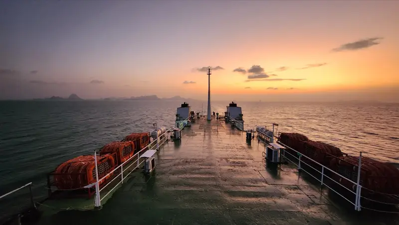
The ferry: timetable and fares
| Raja Ferry route | Passenger, THB | Car, THB | Crossing time |
|---|---|---|---|
| Donsak-Lipa Noi | 140-230 | 460-730 | about 1 h 30 min |
| Lipa Noi-Phangan (Thong Sala) | 140-230 | 460-730 | about 1 h 30 min |
Fares are set by a Surat Thani provincial announcement of 6 June 2022 and move in steps with the diesel price; the operator shows the exact fare when you buy. Donsak-Samui boats leave hourly from 05:00 to 19:00 in both directions, and from 30 December to 30 April the operator adds sailings if cars queue at the pier (timetable as of 17 October 2026). Donsak pier is 93.6 km by road from Surat Thani airport. More on getting to the island in our Koh Samui guide.
Housing in Lipa Noi
The Treasury registry (snapshot of 5 August 2024) has no residential condominium with unit titles in Lipa Noi subdistrict. Housing here means houses and villas on land. Foreigners cannot buy land; ownership options are explained in our guide to freehold, the 49% quota and leasehold. The nearest areas with registry condos are Maenam (7 buildings) and Bophut (19). There are no Lipa Noi projects in our sales catalogue.
Living in Lipa Noi
Hospitals. The public Koh Samui Hospital near Nathon is 5.7 km away (location from OpenStreetMap). The private hospitals are all in Bophut subdistrict, 25.1 km and about 28 minutes to Bangkok Hospital Samui.
Schools. There are no OPEC-licensed international schools in the subdistrict. Neighbouring subdistricts have some: Greenacre International in Na Mueang and two schools in Maret near Lamai.
Shops. OpenStreetMap shows one chain store within 2.5 km of the beach as of 17 October 2026, a Family Mart. A market and Lotus’s are in Nathon, 9 km away.
Transport. The ferry to the mainland and to Phangan is in the subdistrict. The airport is 31.9 km away. We found no official songthaew routes and do not publish any.
Lipa Noi vs its neighbours
| Area | Subdistrict | To airport | To public hospital | Condos on registry | International schools |
|---|---|---|---|---|---|
| Lipa Noi | Lipa Noi | 31.9 km | 5.7 km | 0 | 0 |
| Maenam | Maenam | 9.5 km | 18.8 km | 7 | 1 |
| Lamai | Maret | 14.8 km | 18.8 km | 1 | 2 |
| Bophut | Bophut | 6.3 km | 20.3 km | 19 | 2 |
Sources: OSRM routes on OpenStreetMap (17 Oct 2026), Treasury (snapshot 5 Aug 2024), OPEC (17 Oct 2026).
Homes in Lipa Noi
Lipa Noi and nearby areas
Computed from our project registry and catalogue at build time.
| Area | Projects | L1 | Under construction | Completed | On sale |
|---|---|---|---|---|---|
| Lipa Noi | 0 | 0 | 0 | 0 | 0 |
| Maenam | 0 | 0 | 0 | 0 | 6, from ฿4.5M |
| Lamai | 0 | 0 | 0 | 0 | 7, from ฿7.9M |
| Bophut | 0 | 0 | 0 | 0 | 2 |
FAQ
Where is Lipa Noi?
On Koh Samui's west coast, south of Nathon. It is Lipa Noi subdistrict of Ko Samui district, Surat Thani province; its neighbours on the west coast are Ang Thong with Nathon to the north and Taling Ngam to the south. The shore faces the mainland and the Ang Thong archipelago.
Where does the car ferry to Samui dock?
The Raja Ferry from Donsak docks at the Lipa Noi pier (Samui International Port). On the operator's timetable as of 17 October 2026 boats leave hourly from 05:00 to 19:00 in both directions, taking about 1 hour 30 minutes. A ferry to Phangan's Thong Sala pier leaves from the same pier, also about 1.5 hours.
How much is the ferry from Donsak?
Fares are set by a Surat Thani provincial announcement of 6 June 2022 and tied to the diesel price: 140 to 230 baht per passenger, 460 to 730 baht for a car and 200 to 290 baht for a motorbike. The operator shows the exact fare for your travel date.
How far is Lipa Noi from the airport and Chaweng?
The airport is 31.9 km away, about 35 minutes without traffic; from the pier it is 26.8 km to Chaweng, 16.1 km to Lamai and 24.8 km to Maenam (OSRM on OpenStreetMap data).
Are there hospitals and schools in Lipa Noi?
There are no inpatient hospitals or international schools in the subdistrict itself. The public Koh Samui Hospital is 5.7 km away near Nathon. The private hospitals are all in Bophut subdistrict, 25.1 km to Bangkok Hospital Samui. The nearest international schools by subdistrict are in Na Mueang and Maret.
Can I buy a condo in Lipa Noi?
The Treasury registry has no condominium with unit titles in the subdistrict. Housing here is mostly houses and villas on land, and foreigners cannot buy land. Our guide to ownership types explains the 49% quota and leasehold.
When should I visit Samui's west coast?
The same as the rest of the island: February to September. On TMD's 1991-2020 normals for the Ko Samui station, February gets 64 mm of rain, March to September 83-134 mm, and October to December 263-445 mm.
Sources
- DOPA, Ministry of Interior. Population by subdistrict, December 2025
- Raja Ferry. Donsak-Samui-Phangan timetable
- Raja Ferry. Fares under the Surat Thani provincial announcement of 6 June 2022
- Thai Treasury Department. Condominium valuations (condo_all, snapshot 5 Aug 2024)
- Ministry of Public Health, HSS. Licensed private hospitals as of 31 July 2026 (PDF)
- OPEC. Private school register (search: Surat Thani, Ko Samui, international)
- TMD. Climatological Data of Thailand for 30 Year Period (1991-2020), Ko Samui station (48 550)
- DNP. National park entrance fees (table of 2 June 2023)
- OpenStreetMap. Raja Ferry Lipa Noi Pier (node 4703394110)
- OpenStreetMap. Koh Samui Hospital (way 597992960)
- OpenStreetMap, OSRM route: Samui airport to Lipa Noi Beach
- OpenStreetMap, OSRM route: Lipa Noi to Koh Samui Hospital
- OpenStreetMap, OSRM route: Lipa Noi to Nathon
- OpenStreetMap, OSRM route: Lipa Noi to Bangkok Hospital Samui
Found an error or outdated fact? Tell the editors, we will fix it and update the check date.