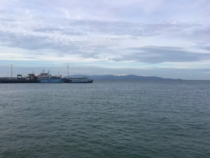

Where Thong Sala is
Thong Sala is the town around Koh Phangan’s main ferry pier on the south-west coast. Administratively it is in Ko Pha Ngan subdistrict of Ko Pha Ngan district, Surat Thani province. The subdistrict had 12,638 registered residents in December 2025: 6,866 inside Ko Pha Ngan municipality and 5,772 outside it. DOPA does not publish a separate figure for the town.
Samui lies across the strait. East along the coast is Ban Tai; the road north leads to Srithanu.
Who Thong Sala suits
- People who travel a lot. On the 2026 Lomprayah timetable boats run between Samui and Phangan from 08:00 to 17:30, a 20-30 minute crossing; Samui-Koh Tao services change boats on Phangan. Raja ferries take cars to Donsak and Samui
- People who want shops nearby. Within 1.5 km OpenStreetMap shows Lotus’s, Big C, Tops, Lim Pi Pong, 17 convenience stores and markets, the densest choice on the island
- People who need a hospital close. The state Ko Pha Ngan Hospital is 4.0 km away, private Phangan International 2.9 km
- People who want to be central. Ban Tai is 8 minutes away, Srithanu 11, Haad Rin 17
Who Thong Sala does not suit
- Anyone looking for a quiet swimming bay. The pier area is a port with boats and ferry traffic; for beaches people go to Srithanu, Haad Salad or south to Ban Tai
- Condo buyers. The Treasury registry lists no condominiums on Phangan: the market is villas and houses, and tenure must be checked in the documents
- Anyone who needs a large private hospital. The big ones are on Samui: Bangkok Hospital Samui (50 beds) and Wattanapat Samui (53)
Thong Sala in numbers
| Indicator | Value | Source, date |
|---|---|---|
| Residents of Ko Pha Ngan subdistrict | 12,638 | DOPA, December 2025 |
| Condos on the Treasury registry | 0 | Treasury, snapshot of 05.08.2024 |
| Rent | to be confirmed | no own measurements yet |
| Boat to Samui | 20-30 min, 250-350 baht | Lomprayah, 2026 timetable |
| Ferry to Donsak | about 2 h 30 min | Raja Ferry, 17.10.2026 |
| To the state hospital | 4.0 km, 6 min | OSRM, 17.10.2026 |
| Annual rainfall | 1,994 mm | TMD, 1991-2020 normals, Ko Samui station |
The seasons are the same as on Samui: driest in February (64 mm) and April (83 mm), wettest from October to December, with 445 mm in November. Month by month in the Koh Phangan hub.
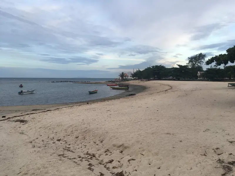
Housing in Thong Sala
There are no condominiums from the Treasury registry here, as on the rest of Phangan (snapshot of 05.08.2024). Housing in town means houses, townhouses and villas in the hills behind it. Foreigners cannot own land in their own name, so villas are usually held on a 30-year land lease: see our freehold and leasehold guide. We do not publish rents by area until we have our own dated measurements.
Living in Thong Sala: schools, hospitals, shops, transport
Schools. The state school Wat Rat Charoen (Moo 1, Ko Pha Ngan subdistrict, 339 pupils in 2020 by OBEC). The secondary school Ko Phangan Suksa (599 pupils) is on the Thong Sala-Ban Tai road. The OPEC-licensed international schools, Siripanya and Phangan International, are in Ban Tai subdistrict.
Hospitals.
| Hospital | Type | km from the pier | Minutes without traffic |
|---|---|---|---|
| Phangan International | private, 9 beds | 2.9 | 4 |
| Ko Pha Ngan Hospital | state | 4.0 | 6 |
| Thai International Phangan | private, 29 beds, Ko Pha Ngan subdistrict | to be confirmed | to be confirmed |
Private hospital beds from the HSS list of 31.07.2026, OSRM distances on 17.10.2026.
Shops. Within 1.5 km of the centre OpenStreetMap shows Lotus’s, Big C, Tops, Lim Pi Pong and one more supermarket, 17 convenience stores and markets including Phanthip market (17.10.2026).
Transport. Thong Sala pier links the island with Samui, Koh Tao and the mainland. We found no official routes with timetables on the island: taxi, scooter or car.
Thong Sala compared
| Area | Subdistrict | From Thong Sala pier | To the state hospital | International schools in subdistrict |
|---|---|---|---|---|
| Thong Sala | Ko Pha Ngan | 0 | 4.0 km | none |
| Ban Tai | Ban Tai | 4.8 km, 8 min | 7.5 km | 2 |
| Srithanu | Ko Pha Ngan | 7.2 km, 11 min | 4.5 km | none |
| Haad Rin | Ban Tai | 11.0 km, 17 min | 13.8 km | 2 (in the subdistrict, not the village) |
Sources: OSRM routes on OpenStreetMap (17.10.2026), OPEC register (17.10.2026).
Homes in Thong Sala
Thong Sala and nearby areas
Computed from our project registry and catalogue at build time.
| Area | Projects | L1 | Under construction | Completed | On sale |
|---|---|---|---|---|---|
| Thong Sala | 0 | 0 | 0 | 0 | 0 |
| Ban Tai | 0 | 0 | 0 | 0 | 0 |
| Srithanu | 0 | 0 | 0 | 0 | 2, from ฿7.8M |
| Haad Rin | 0 | 0 | 0 | 0 | 0 |
FAQ
Where is Thong Sala?
On the south-west coast of Koh Phangan, facing Samui. The town is in Ko Pha Ngan subdistrict of Ko Pha Ngan district, Surat Thani province. It has the island's main ferry pier, used by Lomprayah boats and Raja Ferry.
How do I get from Thong Sala to Haad Rin?
11.0 km along the south coast road, about 17 minutes without traffic by OSRM. We found no official songthaew routes with fares, so people use taxis, scooters or cars.
How long is the boat from Thong Sala to Samui?
20-30 minutes by Lomprayah catamaran or speedboat to Bangrak, Plai Laem or Nathon piers, 250-350 baht on the 2026 timetable. The Raja car ferry to Lipa Noi pier on Samui takes about 1 hour 30 minutes.
Are there supermarkets in Thong Sala?
Yes. OpenStreetMap on 17.10.2026 shows Lotus's, Big C, Tops and the local Lim Pi Pong supermarket within 1.5 km of the centre, plus 17 convenience stores and markets including Phanthip market. It is the largest choice of shops on the island.
Where is the nearest hospital?
The state Ko Pha Ngan Hospital is 4.0 km from the pier, about 6 minutes. The private Phangan International (9 beds) is 2.9 km away on the Ban Khai road. Thai International Phangan, a private hospital with 29 beds, is also in Ko Pha Ngan subdistrict (Ministry of Public Health list, 31.07.2026).
Can I buy a condo in Thong Sala?
The Treasury registry lists no condominiums on Phangan, so a freehold condo under the foreign quota is hard to find here. Offers are mostly villas and houses on leased land; tenure has to be checked in the documents at the Land Department before buying.
Which schools are in Thong Sala?
The state primary school Wat Rat Charoen in Moo 1 of Ko Pha Ngan subdistrict (339 pupils in OBEC 2020 data); the island's only secondary school, Ko Phangan Suksa, is on the Thong Sala-Ban Tai road. Both OPEC-licensed international schools are in neighbouring Ban Tai subdistrict.
Sources
- DOPA, Ministry of Interior. Population by subdistrict, December 2025
- Lomprayah. 2026 timetable
- Raja Ferry. Donsak-Samui-Phangan timetable
- Raja Ferry. Fares under the Surat Thani provincial notice of 06.06.2022
- Thai Treasury. Condominium valuations (condo_all, snapshot of 05.08.2024)
- Ministry of Public Health, HSS. Licensed private hospitals as of 31.07.2026 (PDF)
- OPEC. Ministry of Education private school register
- OBEC. State school list (obec-school-007, 2020 academic year)
- TMD. Climatological Data of Thailand for 30 Year Period (1991-2020), Ko Samui station
- OpenStreetMap. Thong Sala pier (way 171750819)
- OpenStreetMap, Overpass API: shops and markets, data as of 17.10.2026
- OpenStreetMap, OSRM route: Thong Sala pier to Ko Pha Ngan Hospital
- OpenStreetMap, OSRM route: Thong Sala pier to Phangan International Hospital
Found an error or outdated fact? Tell the editors, we will fix it and update the check date.