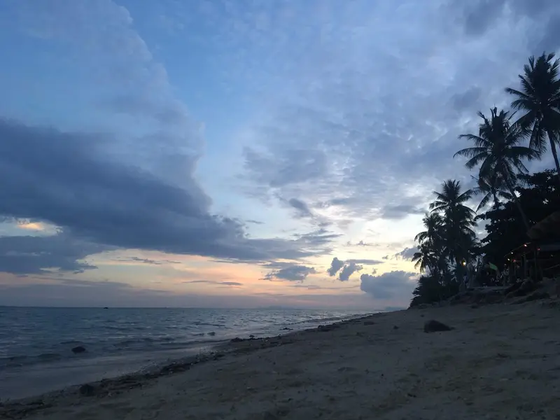

Where Ban Tai is
Ban Tai (บ้านใต้, “the southern village”) is a village and beach on the south coast of Koh Phangan, between Thong Sala and Haad Rin. Ban Tai subdistrict is wider than the village: it covers the south coast with Ban Tai and Ban Khai beaches, the Haad Rin peninsula and the whole east coast up to Thong Nai Pan. In December 2025 it had 5,257 registered residents: 3,657 outside Ko Pha Ngan municipality and 1,600 inside it.
The south coast faces Samui; the north shore of Samui is about 14 km away in a straight line.
Who Ban Tai suits
- Families with school-age children. Both of Phangan’s Ministry of Education licensed international schools, Siripanya and Phangan International, are registered in Moo 1 of Ban Tai subdistrict, and the state secondary school Ko Phangan Suksa is nearby
- People who want a hospital close. Private Phangan International is 1.8 km away, the state hospital 7.5 km
- Frequent travellers. Thong Sala pier is 4.8 km and 8 minutes away
- People who want to live between Thong Sala and Haad Rin. Both are 8-11 minutes by road
Who Ban Tai does not suit
- Anyone who needs a supermarket nearby. OpenStreetMap shows 11 convenience stores and no supermarket within 1.5 km of the beach; Lotus’s, Big C and Tops are in Thong Sala
- Condo buyers. The Treasury registry lists no condominiums on Phangan
- Anyone who wants parties at the door. The island’s main parties are in Haad Rin, 11 minutes away
Ban Tai in numbers
| Indicator | Value | Source, date |
|---|---|---|
| Residents of Ban Tai subdistrict | 5,257 | DOPA, December 2025 |
| International schools in the subdistrict | 2 | OPEC, 17.10.2026 |
| Convenience stores / supermarkets within 1.5 km | 11 / 0 | OpenStreetMap, 17.10.2026 |
| Condos on the Treasury registry | 0 | Treasury, snapshot of 05.08.2024 |
| To Thong Sala pier | 4.8 km, 8 min | OSRM, 17.10.2026 |
| To Phangan International Hospital | 1.8 km, 3 min | same |
| Annual rainfall | 1,994 mm | TMD, 1991-2020 normals, Ko Samui station |
Housing in Ban Tai
The Treasury registry lists no condominiums on Phangan (snapshot of 05.08.2024). In Ban Tai housing means houses, villas and bungalows by the shore and in the hills. Foreigners cannot own land in their own name, so a 30-year lease is the usual route; the tenure of each property has to be checked in the documents. See freehold and leasehold. We do not publish rents until we have our own dated measurements.
Living in Ban Tai: schools, hospitals, shops, transport
Schools.
| School | Type | Where |
|---|---|---|
| Siripanya International School | international, OPEC | 52/30, Moo 1, Ban Tai subdistrict |
| Phangan International School | international, OPEC | 53/14, Moo 1, Ban Tai subdistrict |
| Ko Phangan Suksa | state secondary, 599 pupils (2020) | 145, Thong Sala-Ban Tai road |
| Chumchon Ban Tai | state primary, 174 pupils (2020) | 64/10, Moo 2 |
Hospitals.
| Hospital | Type | km from Ban Tai beach | Minutes without traffic |
|---|---|---|---|
| Phangan International | private, 9 beds | 1.8 | 3 |
| Ko Pha Ngan Hospital | state | 7.5 | 12 |
Beds from the HSS list of 31.07.2026, OSRM distances on 17.10.2026.
Shops. 11 convenience stores within 1.5 km on OpenStreetMap; the big supermarkets are in Thong Sala, 8 minutes away.
Transport. We found no official routes with timetables: scooter, car, taxi.
Ban Tai compared
| Area | Subdistrict | From Thong Sala pier | To the state hospital | International schools |
|---|---|---|---|---|
| Ban Tai | Ban Tai | 4.8 km | 7.5 km | 2 in the subdistrict |
| Thong Sala | Ko Pha Ngan | 0 | 4.0 km | none |
| Haad Rin | Ban Tai | 11.0 km | 13.8 km | none in the village |
| Srithanu | Ko Pha Ngan | 7.2 km | 4.5 km | none |
Sources: OSRM on OpenStreetMap and OPEC, 17.10.2026.
Homes in Ban Tai
Ban Tai and nearby areas
Computed from our project registry and catalogue at build time.
| Area | Projects | L1 | Under construction | Completed | On sale |
|---|---|---|---|---|---|
| Ban Tai | 0 | 0 | 0 | 0 | 0 |
| Thong Sala | 0 | 0 | 0 | 0 | 0 |
| Haad Rin | 0 | 0 | 0 | 0 | 0 |
| Srithanu | 0 | 0 | 0 | 0 | 2, from ฿7.8M |
FAQ
Where is Ban Tai?
On the south coast of Koh Phangan, east of Thong Sala. Ban Tai subdistrict is large: it covers the south coast with Ban Tai and Ban Khai beaches, the Haad Rin peninsula and the east coast up to Thong Nai Pan. In listings, Ban Tai usually means the south coast by the beach.
Which schools are in Ban Tai?
The OPEC register lists two international schools in the subdistrict, the only ones on the island: Siripanya International School (52/30, Moo 1) and Phangan International School (53/14, Moo 1). State schools include Chumchon Ban Tai primary (174 pupils) and Ko Phangan Suksa secondary (599 pupils), OBEC data for 2020.
Where is the nearest hospital?
The private Phangan International (9 beds) is 1.8 km away, about 3 minutes along the Thong Sala-Ban Khai road. The state Ko Pha Ngan Hospital is 7.5 km, about 12 minutes. Complex care means a trip to Samui.
Can you swim at Ban Tai beach?
The beach is on the south coast facing Samui. We could not find an official description from the local authority: local government sites are behind a Cloudflare check. By TMD normals the driest months are February and April, the wettest October to December.
How far is Ban Tai from Haad Rin?
6.7 km by road, about 11 minutes without traffic by OSRM. Ban Tai works well if you want to visit Haad Rin but live away from the parties.
Can I buy property in Ban Tai?
The Treasury registry lists no condominiums on Phangan. Offers are villas, houses and bungalows, usually on leased land. Tenure and quota must be checked in the documents at the Land Department before buying; see our freehold and leasehold guide.
Sources
- DOPA, Ministry of Interior. Population by subdistrict, December 2025
- OPEC. Ministry of Education private school register (Surat Thani, Ko Pha Ngan, international)
- OBEC. State school list (obec-school-007, 2020 academic year)
- Ministry of Public Health, HSS. Licensed private hospitals as of 31.07.2026 (PDF)
- OpenStreetMap. Phangan International Hospital (way 479123096)
- OpenStreetMap. Ban Tai beach (way 479789131)
- Thai Treasury. Condominium valuations (condo_all, snapshot of 05.08.2024)
- TMD. Climatological Data of Thailand for 30 Year Period (1991-2020), Ko Samui station
- OpenStreetMap, Overpass API: shops, data as of 17.10.2026
- OpenStreetMap, OSRM route: Ban Tai beach to Ko Pha Ngan Hospital
- OpenStreetMap, OSRM route: Ban Tai beach to Haad Rin
Found an error or outdated fact? Tell the editors, we will fix it and update the check date.