

Where Koh Phangan is
Koh Phangan (Ko Pha Ngan) lies in the Gulf of Thailand, north of Koh Samui. Together with Koh Tao it forms Ko Pha Ngan district in Surat Thani province, split into three subdistricts: Ko Pha Ngan (the north, the west coast and Thong Sala), Ban Tai (the south and east, including Haad Rin and Thong Nai Pan) and the island of Koh Tao.
In December 2025 DOPA counted 20,480 registered residents in the district: 12,638 in Ko Pha Ngan subdistrict, 5,257 in Ban Tai and 2,585 on Koh Tao. The real population in season is higher, because foreigners who stay for months are not in this count.
Koh Phangan areas at a glance
| Area | Subdistrict | What it is | From Thong Sala pier |
|---|---|---|---|
| Thong Sala | Ko Pha Ngan | main town, ferries, market, state hospital nearby | 0 |
| Ban Tai | Ban Tai | south coast, both international schools | 4.8 km, 8 min |
| Srithanu | Ko Pha Ngan | west coast, yoga centres, sunsets | 7.2 km, 11 min |
| Haad Rin | Ban Tai | south-east peninsula, parties | 11.0 km, 17 min |
Road distances to the village centre or beach, OSRM routing on OpenStreetMap data, 17.10.2026, no traffic. Roads to the north and east (Thong Nai Pan, Bottle Beach) cross hills, and the routed time understates the real one.
How to get to Koh Phangan
There is no airport on the island. The two usual routes:
- Fly to Samui (USM), then take a boat. On the 2026 Lomprayah timetable boats leave Bangrak, Plai Laem and Nathon piers between 08:00 and 17:30, take 20-30 minutes and cost 250-350 baht, or 450-550 baht with a transfer to your hotel on Phangan. Haadrin Queen also runs from Samui to the pier at Haad Rin
- Fly or take the train to Surat Thani, then the ferry from Donsak. Raja Ferry takes about 2 hours 30 minutes from Donsak to Thong Sala, and about 1 hour 30 minutes between Samui (Lipa Noi pier) and Thong Sala
Raja Ferry fares are set by Surat Thani province. Under the notice of 06.06.2022 they follow the diesel price in steps: 210-300 baht per passenger from Donsak to Phangan and 140-230 baht from Samui to Phangan. Check the current step on the operator’s site on the day.
More on Samui and its airport in our Koh Samui guide.
Weather by month
TMD has no weather station on Phangan; the nearest is on Samui, 20 km south. Its 1991-2020 normals show seasons that run opposite to Phuket’s: dry from February to April, heaviest rain from October to December.
| Month | Rainfall, mm | Rainy days | Mean temperature, °C |
|---|---|---|---|
| January | 127 | 11 | 26.9 |
| February | 64 | 6 | 27.4 |
| March | 116 | 6 | 28.2 |
| April | 83 | 8 | 29.1 |
| May-September | 102-134 a month | 13-15 | 28.0-29.2 |
| October | 295 | 19 | 27.4 |
| November | 445 | 19 | 27.1 |
| December | 263 | 14 | 26.8 |
The annual total is 1,994 mm, less than Phuket (2,272 mm at the Phuket station). In July and August the island gets 102-117 mm a month, two to three times less than Phuket in the same months (240-309 mm).
Housing and prices on Koh Phangan
The Treasury condominium valuation registry (snapshot of 05.08.2024) contains no buildings on Phangan. For comparison, neighbouring Samui has 27 residential condominiums with a median valuation of 46,500 baht/m². The island’s market is therefore almost entirely villas, houses and bungalows, whose prices government registries do not publish.
What this means for a foreign buyer: a condominium unit can be owned freehold within the 49% foreign quota, but land under a villa cannot, so it is usually leased for 30 years. On Phangan nearly everything is offered this way, and the tenure of each property has to be confirmed against the documents at the Land Department. See our guide to freehold, the 49% quota and leasehold. Phangan projects on sale are listed in our catalogue; we check developers against the registries and their own websites.
Living on Koh Phangan: schools, hospitals, getting around
Schools. The Ministry of Education private school register (OPEC) lists two international schools in Ko Pha Ngan district, both in Ban Tai subdistrict: Siripanya International School (52/30, Moo 1) and Phangan International School (53/14, Moo 1). The OBEC list for the 2020 academic year shows nine state schools on the island; the only secondary school, Ko Phangan Suksa, is on the Thong Sala-Ban Tai road (599 pupils).
Hospitals. The state Ko Pha Ngan Hospital is 4.0 km from Thong Sala pier. There are two licensed private hospitals (HSS list of 31.07.2026): Thai International Phangan (29 beds, Ko Pha Ngan subdistrict) and Phangan International (9 beds, Ban Tai subdistrict, on the Thong Sala-Ban Khai road). For complex care people go to Samui, which has six private hospitals; the largest are Wattanapat Samui (53 beds) and Bangkok Hospital Samui (50).
Getting around. We found no official bus or songthaew routes with timetables and fares, so we do not publish any. People get around by scooter, car and taxi. The roads to Thong Nai Pan and Bottle Beach cross the hills; OSRM puts them at 27-41 minutes from the pier, and in practice they take longer.
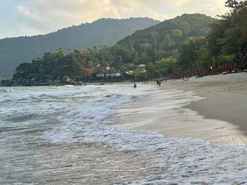
Things to do on Koh Phangan
Beaches, waterfalls, Than Sadet-Ko Pha Ngan National Park and the Haad Rin parties are covered in our Koh Phangan travel guide. Park entry is 100 baht for a foreign adult and 50 baht for a child (DNP fee table, 2023).
Koh Phangan compared
| Koh Phangan | Koh Samui | Phuket | |
|---|---|---|---|
| Registered residents | 17,895 | 70,999 | see Phuket |
| Airport | none, boat from Samui | USM | HKT |
| Condos on the Treasury registry | 0 | 27 | 286 |
| Licensed private hospitals | 2 (38 beds) | 6 | 5 |
| Annual rainfall | 1,994 mm (Ko Samui station) | 1,994 mm | 2,272 mm |
| Driest months | February, April | February, April | January-March |
Sources: DOPA (December 2025), Treasury (snapshot of 05.08.2024), HSS (31.07.2026), TMD (1991-2020 normals).
We can shortlist options on Phangan and Samui for your budget: we process your request and call you back.
FAQ
Where is Koh Phangan?
In the Gulf of Thailand, north of Koh Samui, in Surat Thani province. Phangan and neighbouring Koh Tao form Ko Pha Ngan district, made up of three subdistricts: Ko Pha Ngan, Ban Tai and Ko Tao. The main town and ferry pier, Thong Sala, are on the south-west coast.
How do I get to Koh Phangan?
Only by sea, as the island has no airport. The nearest airport is on Samui, from where Lomprayah runs boats to Phangan between 08:00 and 17:30 for 250-350 baht, a 20-30 minute crossing (2026 timetable). From the mainland, Raja Ferry sails from Donsak to Thong Sala in about 2 hours 30 minutes.
How much is the ferry from Samui to Phangan?
Lomprayah charges 350 baht from Bangrak, Plai Laem (Pralarn) and Nathon piers, 250 baht on some departures, and 450-550 baht with a hotel transfer (2026 timetable). Raja Ferry uses a stepped scale tied to the diesel price: 140-230 baht per passenger between Samui and Phangan under the Surat Thani provincial notice of 06.06.2022.
When is the best time to visit Koh Phangan?
February to April. By TMD normals for the Ko Samui station, February gets 64 mm of rain over 5.6 rainy days and April 83 mm. The wettest months are October to December, with 445 mm and nearly 19 rainy days in November. The seasons do not match Phuket, where rain peaks in September and October.
Koh Phangan or Koh Samui?
Samui is bigger and works like a resort island, with an airport, six licensed private hospitals and condominiums on the government registry. Phangan is smaller and quieter: 17,895 registered residents against 70,999 on Samui, two small private hospitals and no registered condos. Many people live on Phangan and take the boat to Samui for doctors and flights.
Can foreigners buy property on Koh Phangan?
Foreigners cannot own land in Thailand in their own name; the usual routes are a 30-year lease or a condominium unit. Phangan has no condominiums on the Treasury registry, so most offers are villas and bungalows on leased land. Check the tenure in the documents before buying; our freehold and leasehold guide explains how it works.
Is there a hospital on Koh Phangan?
Yes: the state Ko Pha Ngan Hospital, 4 km from Thong Sala pier, and two licensed private hospitals on the Ministry of Public Health list of 31.07.2026, Thai International Phangan with 29 beds and Phangan International with 9. There is no large private hospital on the island; the nearest are on Samui, such as Bangkok Hospital Samui with 50 beds.
Is Koh Tao part of Koh Phangan?
Administratively yes: Koh Tao is a subdistrict of Ko Pha Ngan district with 2,585 registered residents. It is a separate island further north, reached by Lomprayah catamaran from Thong Sala or from Samui with a change on Phangan.
Sources
- DOPA, Ministry of Interior. Population by subdistrict, December 2025
- TMD. Climatological Data of Thailand for 30 Year Period (1991-2020), Ko Samui station 48 550
- Raja Ferry. Donsak-Samui-Phangan timetable
- Raja Ferry. Fares under the Surat Thani provincial notice of 06.06.2022
- Lomprayah. 2026 timetable
- Lomprayah. 2026 timetable (PDF)
- Haadrin Queen. Phangan-Samui boat
- Thai Treasury. Condominium valuations (condo_all, snapshot of 05.08.2024)
- OPEC. Ministry of Education private school register (Surat Thani, Ko Pha Ngan, international)
- OBEC. State school list (obec-school-007, 2020 academic year)
- Ministry of Public Health, HSS. Licensed private hospitals as of 31.07.2026 (PDF)
- OpenStreetMap. Ko Pha Ngan Hospital (way 479775851)
- DNP. National park entrance fees (2023)
- OpenStreetMap, OSRM route: Thong Sala pier to Haad Rin
- OpenStreetMap, OSRM route: Thong Sala pier to Srithanu
Found an error or outdated fact? Tell the editors, we will fix it and update the check date.