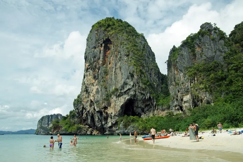

What you will see at Railay
Railay (also Rai Leh) is a peninsula between Krabi Town and Ao Nang. Per Wikipedia it is reachable only by water: high limestone cliffs cut it off from the mainland, and OpenStreetMap shows no road to the beaches. Housing and everyday life at Railay are covered on Railay as a place to live; this page is about what to see and how to get there.
Four areas. Wikipedia names West Railay, East Railay, Phra Nang and Ton Sai.
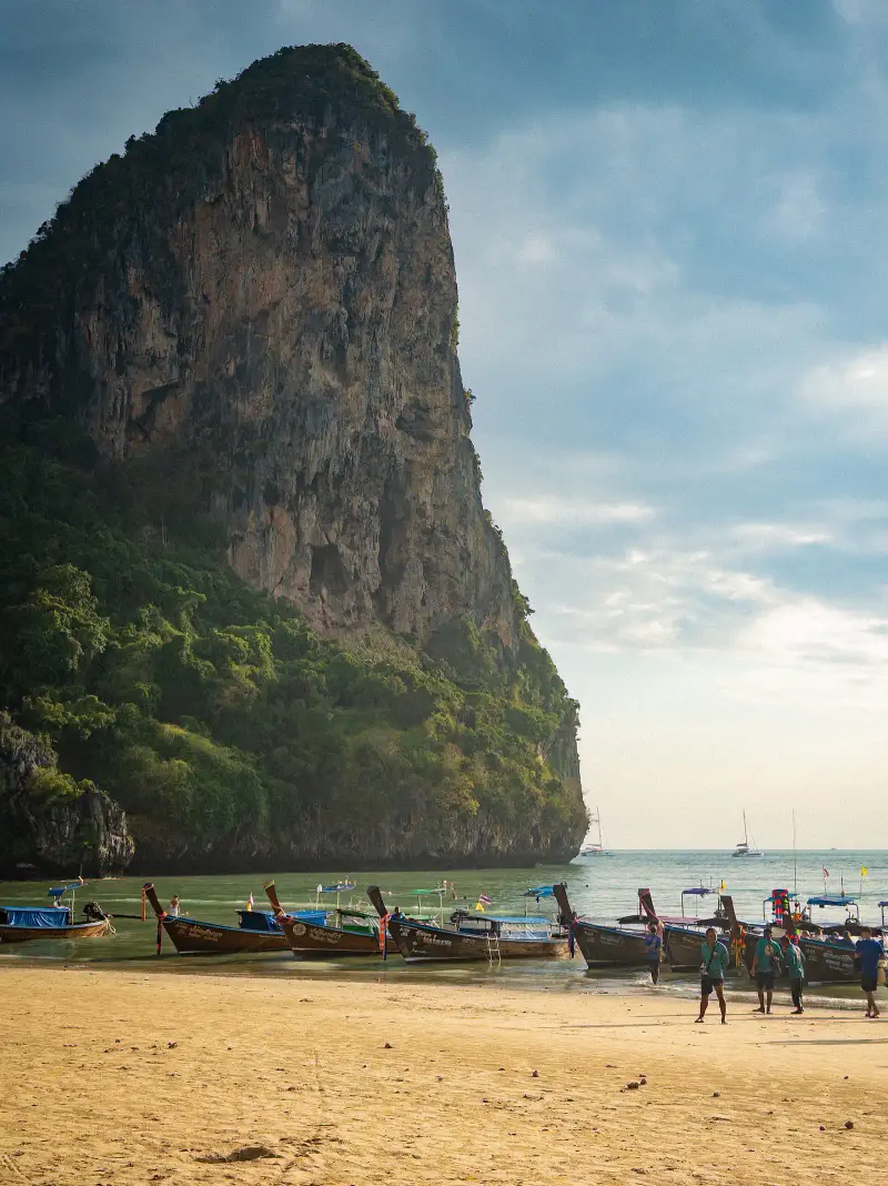
- West Railay. The main swimming beach, with restaurants and shops along a short promenade and the luxury resorts concentrated here. Cliffs rise right above the shore
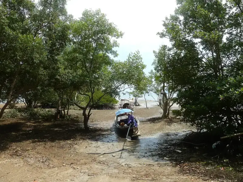
- East Railay. Mostly mangrove and not for swimming, but this is where boats from Krabi Town dock, with a boardwalk of restaurants and a Muay Thai school. At low tide, per Thai Holiday Guide, the beach disappears and mud shows
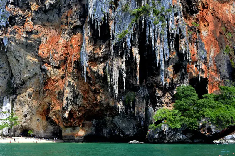
- Phra Nang. A white beach and a cliff with a cave at the southern tip. DNP places it inside the national park
- Ton Sai. A separate bay for climbers and budget travellers, reached by a trail past Diamond Cave
Phra Nang cave. A shrine in the cliff at the edge of Phra Nang beach where people leave carved wooden offerings, asking for fertility and good fishing. Visit Thailand Today says it is an active shrine to be treated like a temple, and the cave itself takes only minutes. According to Thai Holiday Guide, boatmen still stop at the shrine out of respect before continuing to other beaches.
Rock climbing. Climbers have long used the limestone by the beaches. Thai Holiday Guide says Railay has routes for complete beginners and many operators give lessons, and that at Phra Nang routes run from beginner grades up to 7a+.
Lagoon viewpoint. A short climb that, per Thai Holiday Guide, requires scrambling over rocks and rope sections. The guide gives no official duration or difficulty rating.
Hours and how to spend your time
The beaches have no opening hours: Visit Thailand Today says the Phra Nang cave is accessible around the clock, but boats from Ao Nang run only in daytime until sunset. The DNP park page lists a park shop open daily 08:30-16:30 and an information centre at Railay.
- Morning: longtail from Ao Nang, ideally on the first boat around 08:00, which Thai Holiday Guide says carries fewer passengers
- Walk the path to Phra Nang: the longest path between beaches takes 15-20 minutes
- Phra Nang beach and the shrine before 11:00, ahead of the daytime boats
- Lunch and a swim at West Railay
- Return to Ao Nang before sunset, since boats stop around sundown
The busiest hours at Phra Nang, per Thai Holiday Guide, are 11:00 to 15:00, when day-trip boats arrive.
When to go: season
DNP splits the year into two seasons: rain from May to December and dry from January to April, with the most rain in July and the least in February. TMD normals for Krabi station:
| Period | What to expect |
|---|---|
| December-April | dry months, February 35.9 mm; crowds peak December to February |
| May-September | 17-19 rain days a month, boats may be suspended in rough seas |
| October | the wettest month, 292.9 mm and 20.6 rain days |
| November | 198.6 mm, the sea calming; Visit Thailand Today counts November in the best period |
How to get there and how long it takes
From Ao Nang by boat only: 2.7 km in a straight line from Ao Nang beach to West Railay and 3.3 km to Phra Nang (calculated from OpenStreetMap coordinates). Longtails wait at Ao Nang beach, and Thai Holiday Guide gives 15 minutes. Krabi airport is 27.7 km and 33 minutes from Ao Nang, details on the Ao Nang page.
Per Wikipedia, boats from Krabi Town dock at East Railay, while ferries to Phi Phi and Phuket leave from West Railay. From Phuket, sea tours call at Railay and Phra Nang along with the islands; the programmes are covered in Krabi from Phuket and Railay from Phuket.
National park fee and what it covers
Railay, Phra Nang, Ao Nang and Koh Poda lie in Hat Noppharat Thara-Mu Ko Phi Phi National Park; the DNP page separately lists Phra Nang Cave, Rai Le beach and an information centre at Railay. Fee per the DNP table, edition of 02.06.2023:
| Zone | Foreign adult | Child |
|---|---|---|
| Park overall, including Railay and Phra Nang | 200 baht | 100 baht |
| Phi Phi Don, Phi Phi Le, Bamboo Island | 400 baht | 200 baht |
DNP asks you to keep the receipt in case of inspection. Guides say the Phra Nang beach and cave are free (Thai Holiday Guide, July 2026), so we could not confirm how the fee is collected on site. Whether it is included in a boat ticket or tour, ask before paying.
Options: how to spend the day
| Option | Time | Best for | Downside |
|---|---|---|---|
| Longtail from Ao Nang on your own | half a day, 15 minutes each way | those who want to pick their own time | no sailings in rough seas, last boats around sunset |
| Island tour from Ao Nang or Phuket | a day | Poda, Kai and Railay in one outing | little time on the beach |
| A night or more at Railay | 1-3 days | cliffs in the morning and evening without the crowd | luggage carried by hand, ATMs unreliable |
| Climbing with an instructor | half a day | beginners | wet limestone is slippery, not for most in the wet season |
What to do in rain and rough seas
- Boats not running. Postpone, or go inland: Tiger Cave Temple and the Emerald Pool do not depend on the sea
- Rain ashore. Postpone climbing: per Thai Holiday Guide wet limestone is slippery. Skip the lagoon viewpoint trail too, with its rocks and ropes
- Narrow beach. At high tide Phra Nang beach narrows and the walk to the shrine sometimes means wading, so check the tide or ask your boatman
Safety
- DNP lists Ao Rai Le (Railay bay) among tourist areas with high and moderate landslide risk, so take care on trails after downpours
- The lagoon viewpoint trail involves rocks and ropes: flip-flops will not do, wear shoes with grip
- Lighting between the beaches is minimal, and Thai Holiday Guide recommends a headlamp
- The nearest hospital is on the mainland: Wattanapat Ao Nang, a boat to Ao Nang and then 3.6 km by road (from our page Railay as a place to live)
- The cave is an active shrine: behave quietly and cover shoulders and knees, as at a temple
What to bring
- Money. Cash: ATMs on the peninsula are limited and unreliable
- Footwear. Shoes with grip for rocky paths
- Light. A headlamp if you return at dusk
- Clothing. A scarf or sarong for the shrine cave
- Protection. Reef-safe sunscreen and water
Who it suits and who it does not
- Suits. Couples and friends for a day or a couple of nights, beginner climbers, anyone who likes cliffs and calm water, families with older children
- Does not suit. Anyone with heavy luggage or a pushchair. Anyone who needs ATMs and a hospital nearby. Anyone visiting in the wet season who wants certainty: boats do not run in rough seas
FAQ
How do you get from Ao Nang to Railay?
By longtail: Thai Holiday Guide gives 15 minutes, and the straight line from Ao Nang beach to West Railay is 2.7 km. Boats run regularly in the daytime and stop around sunset. From May to October sailings can be suspended in rough seas.
Can you reach Railay by car?
No. OpenStreetMap shows no road to the Railay beaches; the cliffs cut the peninsula off from the mainland, so everyone arrives by boat. Wikipedia also describes Railay as reachable by boat only.
Which beach do the boats land at?
Per Wikipedia, boats from Krabi Town dock at East Railay, while ferries to Phi Phi and Phuket leave from West Railay. Ask your boatman where the Ao Nang longtail will land: East Railay is shallow at low tide, so the landing point can depend on the water.
Is there an entry fee for Railay and Phra Nang beach?
We found no separate ticket for the peninsula. Thai Holiday Guide (July 2026) says entry to Phra Nang beach and the cave is free and the toilets cost 10 baht. The area is inside a national park, though: the DNP table gives 200 baht for a foreign adult and 100 baht for a child, and DNP asks you to keep the receipt. We could not confirm how the fee is collected on site.
Which Railay beach is best for swimming?
West Railay and Phra Nang. Wikipedia says East Railay is mostly mangrove and unsuitable for swimming, and Thai Holiday Guide adds that it is shallow and the beach disappears at low tide. Phra Nang has calm, clear water, but at high tide it narrows and the walk round the rocks to the shrine can mean wading.
Is Railay suitable for children?
For the beaches, yes: the boat takes 15 minutes. But the peninsula is on foot only, pushchairs and heavy bags are hard to manage, and the trail to the lagoon viewpoint involves scrambling over rocks and rope sections per Thai Holiday Guide. With small children stick to Phra Nang and West Railay and skip the viewpoint.
Can a beginner try rock climbing at Railay?
Yes. Thai Holiday Guide says there are routes for complete beginners and local operators give lessons. At Phra Nang beach, per the same guide, routes run from beginner grades up to 7a+. In the wet season wet limestone is slippery, and climbing is not suitable for most visitors then.
When is the best time to visit Railay?
December to April: TMD normals for Krabi station give 35.9 mm and 4.3 rain days in February and 96.8 mm in January. From May to November it rains 17-21 days a month and October brings 292.9 mm. Visit Thailand Today names November to April as the best period, with crowds peaking from December to February.
Sources
- DNP. Hat Noppharat Thara-Mu Ko Phi Phi National Park (park page)
- DNP. Entrance fees for individuals in national parks, edition of 02.06.2023
- TMD. Climatological Data of Thailand for 30 Year Period (1991-2020), Krabi station (48 563)
- OpenStreetMap. Railay Bay (relation 18 543 708)
- Wikipedia. Railay (general information, areas, access; carries a 'needs citations' tag)
- Thai Holiday Guide. Railay Beach (updated June 2026)
- Thai Holiday Guide. Phranang Cave Beach (updated July 2026)
- Visit Thailand Today. Princess Cave (updated September 2026)
- Thai Holiday Guide. Ao Nang (updated June 2026)
- OpenStreetMap. Phra Nang beach (relation 19 741 816)
Found an error or outdated fact? Tell the editors, we will fix it and update the check date.