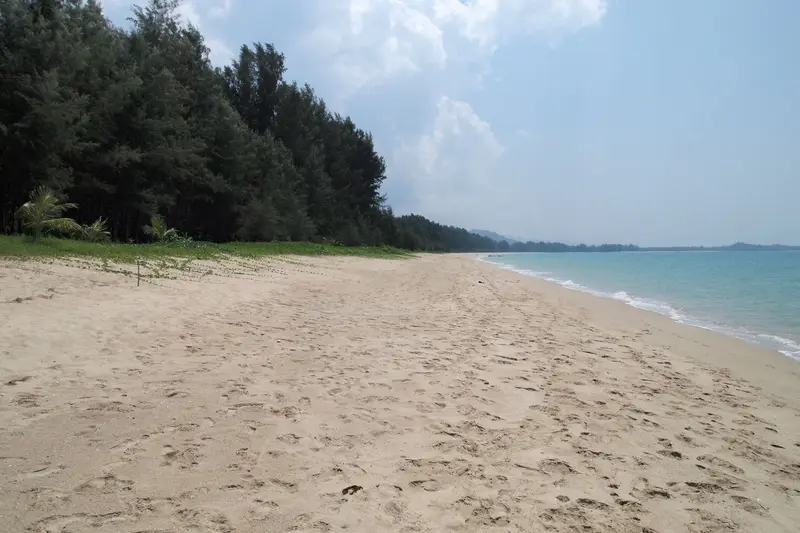

Where is Khao Lak?
Khao Lak (เขาหลัก) is a stretch of Andaman Sea coast in Phang Nga province, north of Phuket. It is mainland, not an island, and not a part of Phuket, even though almost everyone arrives through Phuket Airport. Hotels and guidebooks use the name for the whole line of beaches along Highway 4 (Phet Kasem Road).
On the map it splits into three subdistricts:
- Khuek Khak, Takua Pa district. The main resort strip: Nang Thong, Bang Niang, Khuk Khak and Pak Weep beaches and Laem Pakarang. DOPA counts 7,008 registered residents and 7,716 households here as of December 2025
- Lam Kaen, Thai Mueang district. Further south: Khao Lak village, which gave the resort its name, and Thap Lamu pier for Similan boats
- Bang Muang, Takua Pa district. Further north: Bang Sak Beach and Ban Nam Khem with its tsunami memorial
Takua Pa town is 31 km from Nang Thong Beach. Phuket Airport is 75.7 km away, about 70 minutes without traffic: Highway 402 over the bridge to the mainland, then north on Highway 4.
Khao Lak beaches
Phang Nga’s official list of attractions for Takua Pa district names eight beaches. Roughly north to south:
| Beach | Thai | Where |
|---|---|---|
| Bang Sak | หาดบางสัก | Bang Muang subdistrict, north |
| Pak Weep | หาดปากวีป | Khuek Khak |
| Laem Pakarang | แหลมปะการัง | Khuek Khak, 13.2 km from Nang Thong |
| Khuk Khak | หาดคึกคัก | Khuek Khak |
| Bang Niang | หาดบางเนียง | Khuek Khak |
| Nang Thong | หาดนางทอง | Khuek Khak |
| Hat Lek | หาดเล็ก | not confirmed |
| Khao Lak Beach | หาดเขาหลัก | by the Khao Lak-Lam Ru National Park office |
Khao Lak-Lam Ru National Park has its headquarters on Khao Lak Beach, and DNP describes the shore there as rocky and sandy beaches with coral. Natai Beach is not on the Takua Pa list.
During the southwest monsoon, May to October, the west-facing Andaman beaches often get surf and rip currents. Our guide to red flags and rip currents explains the beach flags.
Khao Lak weather by month
The nearest Thai Meteorological Department station is Takua Pa (48 561). The coordinates in the TMD report (08°41′N, 98°15′E) put it in Khuek Khak, inside the resort strip today, but it was moved after the 2004 tsunami, so not all of the 1991-2020 record comes from this site. Individual beaches may differ. Phuket city station is shown for comparison.
| Month | Rain, Khao Lak | Rainy days | Rain, Phuket | Mean max, Khao Lak |
|---|---|---|---|---|
| January | 62 mm | 6.3 | 50 mm | 32.6 °C |
| February | 45 mm | 5.6 | 24 mm | 33.2 °C |
| March | 145 mm | 10.4 | 81 mm | 33.6 °C |
| April | 222 mm | 15.6 | 135 mm | 33.7 °C |
| May | 431 mm | 22.4 | 237 mm | 32.6 °C |
| June | 457 mm | 21.1 | 249 mm | 31.9 °C |
| July | 466 mm | 22.3 | 240 mm | 31.5 °C |
| August | 570 mm | 22.7 | 309 mm | 31.3 °C |
| September | 636 mm | 24.1 | 350 mm | 30.9 °C |
| October | 529 mm | 24.1 | 336 mm | 31.1 °C |
| November | 232 mm | 16.8 | 178 mm | 31.8 °C |
| December | 78 mm | 9.0 | 82 mm | 31.9 °C |
| Year | 3,873 mm | 200.4 | 2,272 mm | 32.2 °C |
Khao Lak is clearly wetter than Phuket, with close to double the rain from May to October. Only January and February are truly dry, with December and March close behind. DNP describes the park climate the same way: dry from January to April, rain from May to December. Full Phuket normals are on Phuket weather by month, and what the rainy season means in practice is in Phuket low season.
Getting there from Phuket Airport
Khao Lak has no airport of its own; the nearest is HKT in the north of Phuket. OSRM driving distances on OpenStreetMap data, without traffic:
| From → to | Distance | Time |
|---|---|---|
| HKT airport → Khao Lak village | 69.7 km | 65 min |
| HKT airport → Nang Thong Beach | 75.7 km | 70 min |
| HKT airport → Bang Niang Beach | 78.6 km | 75 min |
Car, transfer, taxi and bus options, and what we could and could not verify, are in Khao Lak to Phuket: how to get there.
Similan and Surin islands from Khao Lak
Khao Lak is the closest resort to two marine national parks, which is the main reason divers and snorkellers stay here rather than in Phuket.
| National park | Boats leave from | From Nang Thong | Open | Foreigner fee |
|---|---|---|---|---|
| Similan Islands | Thap Lamu pier | 13.7 km, 13 min | 15 October-15 May | THB 500, child THB 250 |
| Surin Islands | Khura Buri pier | 92.6 km, about 71 min | 15 October-15 May, some bays closed | THB 500, child THB 250 |
Thap Lamu is 71 km from Phuket Airport but only 13.7 km from Khao Lak, so Similan trips start later from here. DNP publishes the season on park pages and in season notices, and can delay individual sites in a given year. The Surin reference page still says 1 November-30 April, but recent DNP season notices open both the Similans and Surin from 15 October to 15 May, with all of Ao Suthep and part of Ao Tao on Surin closed because of coral bleaching. Check the 2026-2027 order before you go. What is closed in the 2026-2027 Similan season is on our Similan Islands page.
The 2004 tsunami and memorials
On 26 December 2004 the tsunami hit Thailand’s west coast. UN OCHA listed six provinces as severely affected, Phang Nga among them. UN country team figures from 13 June 2005 put Thailand’s toll at 5,395 dead and 2,817 missing. The Takua Pa weather station was closed for over a year, until 31 December 2005.
Memorial sites on Phang Nga’s official lists:
- Boat 813 memorial, Bang Niang. Patrol boat 813, carried ashore by the wave, was left where it landed as a memorial. 3.2 km from Nang Thong Beach
- Ban Nam Khem Tsunami Memorial Park. Run by the Phang Nga Provincial Administrative Organization, 26 km north of Nang Thong
- Ban Nam Khem Tsunami Museum. Next to it is a viewing tower that doubles as a shelter
A warning system now covers the coast. The provincial disaster office lists 7 tsunami warning towers in Khuek Khak and Lam Kaen as of 2025, plus 4 in neighbouring Bang Muang, one of them at the Ban Nam Khem memorial.
Khao Lak-Lam Ru National Park
Khao Lak-Lam Ru National Park covers 125 km² of forested hills above the coast. It was declared in 1991 (Royal Gazette vol. 108, part 152, 30 August) as Thailand’s 66th national park. The highest peak is about 1,077 m, and the Takua Pa and Phang Nga rivers rise here.
The park office is on the shore at Khao Lak Beach. The fee is THB 100 for foreign adults and THB 50 for children on DNP’s fee table. The park has bungalows and camping, bookable through DNP.
Who Khao Lak suits
- Similan and Surin trips. Thap Lamu pier is 13.7 km away instead of 71 km from Phuket Airport
- Long beaches and quiet. The official Takua Pa list has eight beaches, two waterfalls and a national park, and no nightlife or malls
- December to March travel. January and February average 6 rainy days a month
- Travellers who care about history. Two tsunami memorials and a museum within 3-26 km of the main beaches
Who it doesn’t suit
- Beach holidays from May to October. 430-636 mm of rain a month, nearly double Phuket, and the Similans are closed
- Frequent flyers. HKT is 70-79 km away, over an hour each way
- Bars, clubs and shopping. For that, stay in Phuket, for example Patong
- Daily trips around Phuket. Nang Thong to Phuket Old Town is 100.8 km, about an hour and a half
If you are staying in Phuket and just want to see Khao Lak, one day is enough: route and timings are in our Khao Lak day trip from Phuket guide.
FAQ
Is Khao Lak in Phuket?
No. Khao Lak is on the mainland in Phang Nga, the province north of Phuket island. The confusion comes from the airport: most visitors fly into Phuket and drive 75.7 km to Nang Thong Beach, crossing the bridge to the mainland and heading north on Highway 4.
Is Khao Lak an island?
No, it is a strip of mainland coast. The islands are offshore: boats to the Similan Islands leave from Thap Lamu pier, 13.7 km from Nang Thong Beach. The Surin Islands are further north, about 70 km off the coast according to DNP.
How far is Khao Lak from Phuket?
From Phuket Airport it is 69.7 km to Khao Lak village and 75.7 km to Nang Thong Beach, 65-75 minutes without traffic by OSRM routing. From Patong or Phuket Old Town it is about 100-104 km and an hour and a half. Transfer and bus options are covered in our Khao Lak to Phuket answer.
When is the best time to visit Khao Lak?
December to March. On TMD 1991-2020 normals January averages 62 mm of rain over 6 rainy days, February 45 mm, December 78 mm and March 145 mm. From May to October every month gets 430-636 mm and 21-24 rainy days, roughly double Phuket.
Is October a good month for Khao Lak?
Only if you can live with rain: October is one of the wettest months, with 529 mm and 24 rainy days on TMD normals. The upside is that the Similan Islands reopen on 15 October. Recent DNP season notices open the Surin Islands on 15 October too, with some bays closed because of coral bleaching.
What happened in Khao Lak in the 2004 tsunami?
Phang Nga was one of six provinces that UN OCHA listed as severely affected, and Thailand as a whole counted 5,395 dead and 2,817 missing (UN country team figures, 13 June 2005). Memorials stand at Bang Niang, where patrol boat 813 was carried ashore, and at Ban Nam Khem. Today the Khuek Khak and Lam Kaen subdistricts have 7 tsunami warning towers, according to the provincial disaster office.
What is there to do in Khao Lak?
Phang Nga's official list for Takua Pa district includes the beaches, Sai Rung and Ton Chong Fa waterfalls, Khao Lak-Lam Ru National Park, boat trips on Khlong Sang Ne canal (Little Amazon), Takua Pa old town and the two tsunami memorials. From Phuket you can see the main sights in a day, see our Khao Lak day trip guide.
Sources
- Phang Nga Provincial Office of Tourism and Sports. Tourist attractions in the province (open data, CSV)
- Phang Nga Provincial Culture Office. Cultural sites and memorials (open data, CSV)
- Phang Nga Provincial Disaster Prevention Office (DDPM). Tsunami warning towers, 2025 (open data, CSV)
- DNP. Khao Lak-Lam Ru National Park
- DNP. Mu Ko Similan National Park: description, season, access
- DNP. Mu Ko Surin National Park
- Krungthep Turakij. DNP opens Similan, Surin and Laem Son season to 15.05.2025 (17.10.2024), media
- DNP. National park entrance fees for individuals (CSV)
- TMD. Climatological Data of Thailand for 30 Year Period (1991-2020), Takua Pa (p. 81) and Phuket (p. 82) stations
- DOPA, Ministry of Interior. Population by subdistrict, December 2025
- ADRC. Thailand: Tsunami 2004/12/26 (GLIDE TS-2004-000147-THA), UNCT and OCHA figures
- OpenStreetMap, OSRM route: HKT airport to Nang Thong Beach
- OpenStreetMap, OSRM route: HKT airport to Khao Lak village
- OpenStreetMap, OSRM route: HKT airport to Bang Niang Beach
- OpenStreetMap, OSRM route: Nang Thong Beach to Thap Lamu pier
- OpenStreetMap, OSRM route: Nang Thong Beach to Khura Buri
- OpenStreetMap, OSRM route: Nang Thong Beach to Boat 813 memorial
- OpenStreetMap, OSRM route: Nang Thong Beach to Ban Nam Khem memorial
- OpenStreetMap, OSRM route: Nang Thong Beach to Laem Pakarang
Found an error or outdated fact? Tell the editors, we will fix it and update the check date.